
Beneath the plains of East Africa, the ground is quietly changing shape. GPS stations, satellite radar and field geologists now track subtle tears that lengthen year after year. As faults step down and magma pries the crust apart, valleys sink, lakes stretch and new volcanoes rise. What looks like solid rock is slowly loosening its grip, hinting at coastlines not yet drawn. Scientists say this continental rift could, over deep time, open a new ocean, reshaping borders, resources and risk.
East African Rift: where a continent starts to split
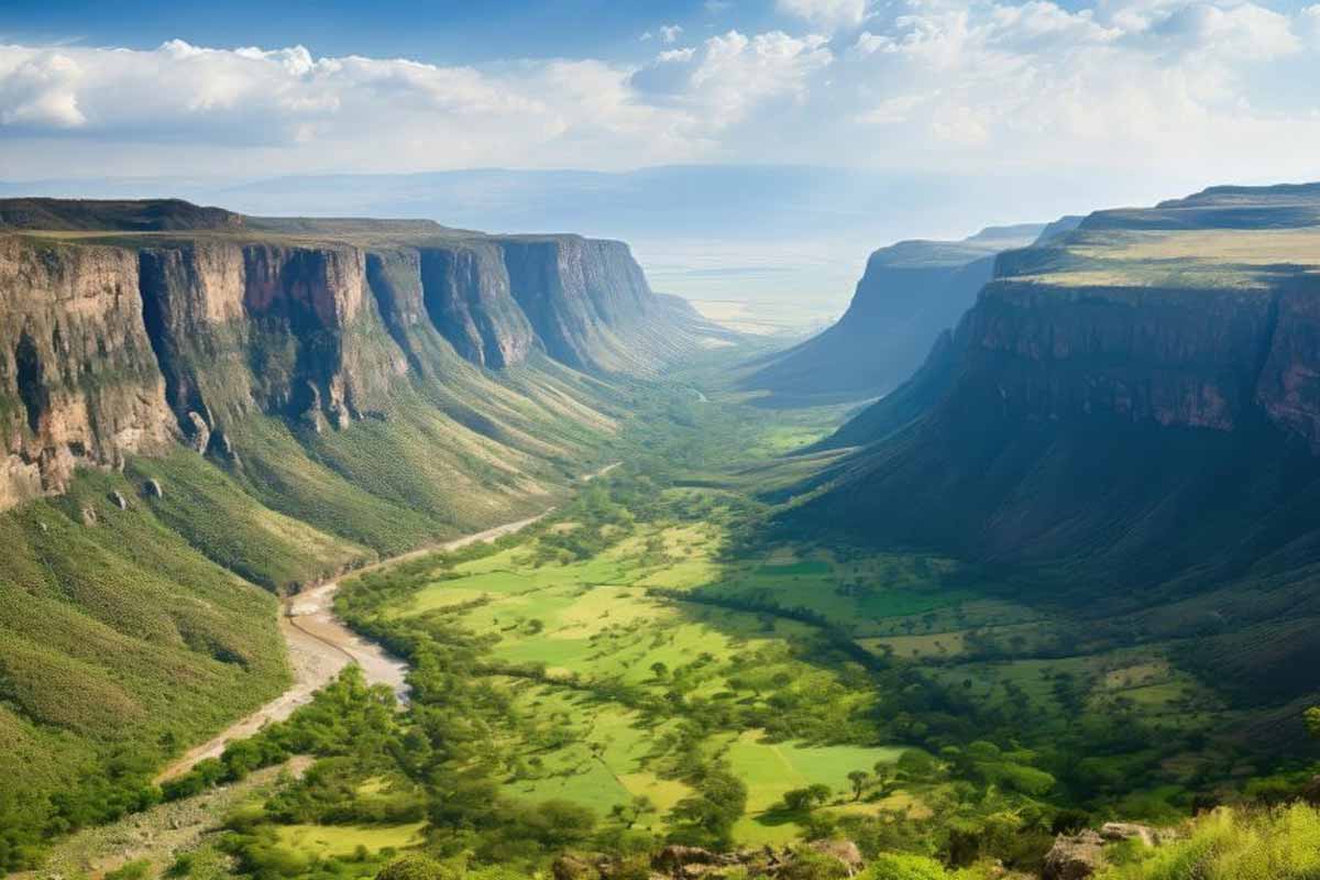
The East African Rift stretches more than 3,000 kilometers from Ethiopia’s Afar region through Kenya and Tanzania to Mozambique. Here, the African Plate divides into the Nubian block on the west and the Somali block on the east. Scientists compare the setting to a living laboratory. Because every fault, dike, and volcanic field shows change.
Heat rising from deep mantle rock thins the lithosphere, so stresses crack the crust. Magma wedges into those cracks, then cools to form new rock. This is how oceans begin. The process mirrors the early Atlantic, which opened after South America drifted from Africa about 180 million years ago, when plate boundaries reorganized.
Rift widening sounds tiny at a few millimeters per year, yet the math adds up. Over millions of years, those millimeters become hundreds of kilometers. That’s why specialists say the seeds of a new ocean already exist beneath eastern Africa. The land flexes, the ground shakes, and valleys sink as blocks slip and rotate.
How a new ocean begins under our feet
At Afar, the rift meets the Red Sea and the Gulf of Aden in a rare triple junction. Three plate boundaries intersect, so spreading, faulting, and volcanism stack together. This crossroads hosts frequent earthquakes and young lava flows, which outline the direction the crust is pulling. NASA imagery tracks these changes season after season.
Beneath the surface, magma intrusions open vertical fractures called dikes. These dikes push rock sideways, while shallow faults step down to form long valleys. Over time, the valley floors drop and thin. When seawater finally spills in, a narrow basin becomes a spreading ridge. The cycle shifts from continental rifting to seafloor growth.
Christopher Scholz, a geophysicist at Syracuse University, frames East Africa as a front-row view of continental breakup. His point resonates because researchers combine GPS, radar interferometry, and field geology to watch shifts as they happen. Those tools, supported by work from the Geological Society of America and the U.S. Geological Survey, tighten timelines and illuminate early ocean birth.
Surface signs: quakes, lava, and a changing landscape
People already notice the rift at the surface. In 2018, a several-kilometer fissure emerged in southwestern Kenya, severing roads and fields. Intense rainfall helped reveal it, yet subsequent investigations connected the fracture to deeper tectonics. The incident demonstrated how rapidly ground can shift when a fault ruptures under stress and water.
In the Afar Depression of Ethiopia, frequent eruptions and clusters of minor tremors indicate zones where magma ascends. Black basalt flows cool into ropey textures and fresh plates of rock. Those features, mapped from space and checked on the ground, match the rift’s geometry. They also outline future shorelines as low areas keep sinking.
Infrastructure feels the strain. Roads crack, pipelines buckle, and homes settle where sediments shift. Good practice calls for flexible designs, careful siting, and monitoring that blends GPS with local surveys. Communities need clear hazard plans because the same forces that may one day form a new ocean also trigger short, damaging events right now.
Timelines, numbers, and maps of a possible new ocean
Rates matter, so scientists quantify them carefully. The rift widens by a few millimeters yearly, modest to the eye yet decisive through geologic time. If present trends hold, many researchers expect seawater to flood parts of the rift valley in roughly 5 to 10 million years. That scale guides long-range scenarios, not daily decisions.
When that threshold arrives, the Red Sea and the Gulf of Aden could breach interior basins and connect. New coastal outlines may isolate parts of Ethiopia, Kenya, Tanzania, and Mozambique as an elongated block, a bit like Madagascar today. Once water enters, oceanic crust can grow along a spreading ridge, carving a lasting marine gateway.
These projections rely on stacked evidence: satellite data, ground GPS, seismology, and chemistry of young lavas. NASA archives show widening valleys; USGS catalogs quakes that track active faults; peer-reviewed studies quantify uplift and thinning. Together they build a consistent picture, even as uncertainties remain about exactly where the new ocean will first cut through.
Why this slow split reshapes science and society
Earth never stands still, and the East African Rift proves it with numbers, maps, and lived experience. The land pulls apart millimeter by millimeter while researchers watch and communities adapt. One day, tides may roll across this valley and fill a basin that becomes a new ocean. Until then, knowledge, care, and bold planning can turn risk into resilience.