
Eight states face fast-changing conditions as snow, frost, and hard freezes arrive together. The National Weather Service signals slick roads in the north and threats to gardens in the East. Up to six inches could stack up at higher elevations, while pipes and crops stay exposed. Residents should prepare early, because Winter Weather squeezes travel plans and outdoor work without warning. Alerts arrive quickly, so planning routes, covering plants, and checking updates can limit surprise impacts.
Where alerts are in force and what they cover
The National Weather Service issued advisories across central Alaska and parts of the Northeast. Alerts stretch to Alaska, Colorado, New York, Vermont, New Hampshire, Pennsylvania, Maine, and Massachusetts. Forecasters cite hazardous driving in snowy corridors, as vegetation risks expand eastward with frost and freeze warnings. Pipes face exposure.
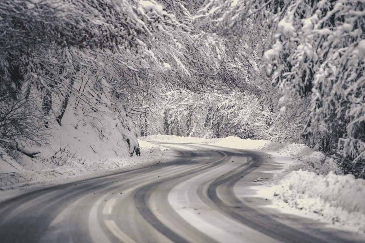
Central Alaska’s alert includes the Chena Hot Springs Resort area and Chena Hot Springs Road east of milepost 34. Forecasters expect three to five inches there, which can ice bridges and shade-prone curves. Plows react quickly, yet traction drops fast when snow packs over cold pavement and untreated shoulders.
Another alert targets stretches along the Steese Highway, up to around mile marker 90, and higher elevations in the White Mountains. Totals may reach six inches on exposed ridges, so steep grades glaze quickly. Commuters should allow extra time as Winter Weather challenges braking distance and lane visibility.
Alaska’s Winter Weather setup and snowfall amounts
Forecast discussions point to the White Mountains as the snow core, with the Steese and Eagle Summits and the Upper Chatanika Valley favored. Elevation controls totals, as colder air lingers near peaks. Lower corridors see lighter bands, while sheltered valleys collect bursts when upslope winds align well.
Along Chena Hot Springs Road east of milepost 34, road surface temperatures drop quickly beneath flurries, so bridges and shaded bends become slick. Three to five inches can bury reflectors, and plow berms narrow lanes. Visibility drops near resort turnouts when passing squalls reload wind-prone cuts at dusk.
On the Steese Highway, up to mile marker 90, gradients steepen near summits; higher elevations in the White Mountains can see up to six inches. Drivers should carry traction aids, because shoulders drift. This corridor funnels gusts, and Winter Weather often sculpts hardpack that surprises curves overnight.
Northeast frost and freeze risks to vegetation
Freeze warnings cover parts of New York, Vermont, and New Hampshire, with sub-freezing temperatures in the upper twenties and low thirties. Notices remained in effect until Thursday morning as of reporting, so gardeners should protect tender plants. Sensitive shrubs, annuals, and produce suffer tissue damage when radiational cooling clears skies.
Frost advisories reach northern and central Pennsylvania, southern Maine, western Massachusetts, and Colorado’s central and southern San Luis Valley. Temperatures settle in the thirties, so crystals form on exposed leaves and lawns. Garden hoses and exterior faucets need protection, while unheated sheds trap cold air that prolongs surface icing.
Unprotected outdoor plumbing also faces risk, because frost can seize valves and split fittings. The NWS office in Burlington noted a freeze warning and frost advisory for parts of the region tonight, with conditions cold enough for a hard freeze. Residents should insulate spigots as Winter Weather trends sharpen overnight.
Timing of Winter Weather alerts and commuting impacts
Alaska’s alerts run from 2 p.m. Thursday through 10 p.m. AKDT Friday. The window spans the Thursday evening and Friday morning commutes, so motorists should expect slippery roads and reduced stopping distance. Crews may stagger treatments, while ramps and bridge decks cool faster than lanes, which magnifies risk at merges.
Forecasters in Fairbanks highlighted moderate to heavy snowfall for the White Mountains, with the highest amounts near the Steese and Eagle Summits and the Upper Chatanika Valley from Thursday evening into Friday night. At lower elevations, mixed precipitation can glaze intersections, as sleet or freezing rain briefly coats untreated surfaces.
Drivers should slow before curves, because traction disappears faster than visibility in crosswinds. Checking tire tread and washer fluid helps, while a full tank supports detours. Keep an ice scraper and warm layers accessible, since Winter Weather often shifts intensity between valleys and ridges within a single hour.
What forecasters say about the days ahead
From Binghamton, meteorologist Mark Pellerito anticipated a chilly Thursday night, with lower to mid-thirties in the coldest locations. He noted many counties under current freeze warnings could still see frost advisories Thursday night. Gardeners should plan for covers, while rural hollows cool fastest under clearing skies and light wind.
After Thursday night, guidance turns warmer through the weekend and into at least midweek. Highs reach widespread seventies to near eighty under full sunshine, so outdoor projects bounce back quickly. Cold soils linger in shaded spots, yet daytime warmth resets frost risk until another clear, calm night aligns.
Regional NWS offices update websites and social feeds often, which helps communities track shifting advisories. Colorado’s San Luis Valley benefits from quick notices, because valleys trap cold air before dawn. Staying subscribed keeps alerts timely as Winter Weather and frost products transition, then taper, during the early warmup phase.
Practical steps to protect travel plans and property now
Cover sensitive plants, drain hoses, and insulate spigots today, because small actions prevent big losses. Check tire pressure, wipers, and battery health; pack gloves and an emergency scraper. Review school or work policies for delayed starts. Finally, follow local NWS channels as Winter Weather evolves, so you adjust routes and protect investments. Keep pets indoors during overnight lows, and move delicate containers into garages. If you manage projects outdoors, sequence deliveries later in the day while roads improve.